
Drone mapping and UAV surveys are mixing things up in how land surveying gets done. As someone who works closely with survey technology, I’ve seen how drones make it possible to capture detailed data quickly and safely. These advances not only help surveyors, but they also open up new opportunities in construction, agriculture, and urban planning. In this guide, I’ll walk through the basics of drone mapping, how it all works, and why it’s so useful for land and construction surveys.
How Drone Mapping Works
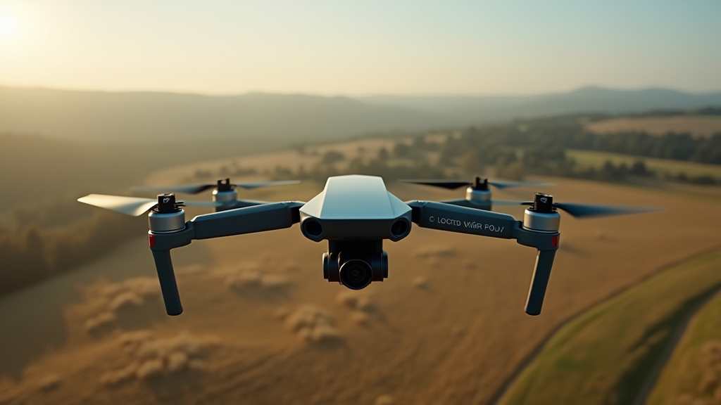
Drone mapping starts with a drone, sometimes called an Unmanned Aerial Vehicle (UAV), equipped with cameras or special sensors. When I fly a drone over a survey site, it takes hundreds or even thousands of overlapping pictures or data points from the air. These images get stitched together by special computer software to produce maps or 3D models of the land below that you can measure.
The process looks like this: I plan a flight path on a map, and the drone follows that path with GPS guidance. The cameras or sensors snap images at regular intervals, each with its own precise location tagged. Once the flight is over, mapping software uses all those photos to build a super detailed, accurate map from the air. This technique is called photogrammetry. Some drones can also carry LiDAR sensors, which use lasers to measure distance, providing even more detailed topographical information for tough terrain or places with a lot of tree cover.
- Photogrammetry: Uses overlapping photos and computer algorithms to create maps and 3D models you can trust for measuring real-world features.
- LiDAR: Uses laser scanning to map both the ground surface and features on top, even under thick trees.
- RTK/PPK GPS: Advanced GPS tech that boosts mapping accuracy, often down to a few centimeters, making it a game-changer for engineering projects.
This whole workflow lets me and other surveyors turn aerial images into precise measurements that teams rely on for their most important projects, including those involving infrastructure or safety concerns.
Why Drones Are Changing Land Surveying
Drones have made some parts of land surveying faster and more efficient than ever. In the past, surveyors had to walk tough or dangerous ground with tripods and GPS units, sometimes spending hours under the sun. Now I can map that same area with a drone in less than an hour and actually get more detail than by hand.
Some of the biggest advantages I notice when using UAVs for surveying projects include:
- Speed: Mapping large or tricky areas quickly, saving days compared to old-school ground teams.
- Safety: Drones fly over dangerous, steep, or remote land where it’s tough or risky for people to go.
- Accuracy: Modern mapping drones rival the old tools and often offer even sharper precision.
- High-Detail Data: Aerial data provides clear 2D maps, 3D models, and records details about vegetation or buildings.
I often use drones to record project progress, inspect crop or soil health, and track material stockpiles at construction sites. This flexibility means I can provide loads of valuable information with each flight, making it easier for teams to make smart decisions quickly.
Key Equipment for Drone Surveys
Not every drone is geared up for mapping or survey work. Here’s the gear I focus on for reliable and professional results:
- Survey Grade Drone: Models with long battery life, strong gimbals, and waypoint flight. Drones like the DJI Matrice line or SenseFly eBee are trending because they’re built for the job.
- Camera or Sensor: High resolution cameras for mapping or specialized LiDAR units for eye-popping elevation maps.
- GPS Modules: Drones with RTK (Real-Time Kinematic) or PPK (Post-Processed Kinematic) GPS tech for pinpoint accuracy.
- Ground Control Points (GCPs): Pre-marked locations on the ground, measured precisely, to lock the aerial map to real-world coordinates.
- Mapping Software: Programs like Pix4D, DroneDeploy, or Agisoft Metashape that process raw data into usable maps and aerial models.
A solid remote controller, a tablet or laptop for overseeing flights, and extra batteries round out a good UAV survey kit. Having a case to keep it all safe and transporting everything with care is key for consistent results in the field.
Using Drones in Construction and Land Development
Drones are helping construction companies and land developers with countless parts of their daily work. I regularly use drones for things like monitoring job site progress, measuring material piles, and checking boundaries. This kind of data makes site inspections and documentation a whole lot more accurate and efficient for everyone involved.
For instance, capturing an aerial image each week lets me build a rich record of project progress; teams can easily compare and spot changes week to week. With repeat flights, I document how earth gets moved, keep tabs on environmental impacts, and help settle disputes by providing visual, up-to-date evidence of actual site conditions.
- Preconstruction Surveys: Fast site checks for planning roads, drainage, and where new buildings should go.
- Cut and Fill Measurements: Calculating how much dirt needs to be moved in big construction projects.
- Volume Calculations: Figuring out how much material is piled up on site, which helps with budgets and delivery schedules.
- Progress Monitoring: Updated aerial maps keep everyone in the loop without all the walking or confusion.
Drones cut down the need for long fieldwork days, especially when it comes to sprawling sites or ones that are hard to walk through.
Common Challenges and How I Handle Them
Like any new tech, drone mapping brings up a few headaches. Here’s what I’ve run into, along with how I deal with them in my day-to-day work:
Weather and Flight Conditions
Bad weather can spoil even the best-laid flight plans, so I always check the forecast and do flights on calm, clear days. Strong winds or surprise rain can make it dangerous or mess up images, so carrying extra batteries and being ready to move fast helps protect my drone and my data.
Regulations and Legal Rules
Each country has rules about flying drones. Sometimes I need to register drones or get special permits for commercial flights. Staying up to date with FAA guidelines in the U.S. (or similar rules in your country) is important. Knowing about no-fly zones and getting permission if needed can help avoid a world of stress later.
Accuracy and Data Quality
To make sure maps are reliable, I use ground points and double-check my GPS data. Things like heavy tree cover or tall buildings can cause map errors, which is why I verify my results and sometimes redo surveys for tricky areas.
Software and Processing
Processing hundreds or thousands of pictures takes some computing power. I use a strong laptop with lots of storage, and back up my images just in case. If software throws an error, I check online forums and support to sort things out or get advice.
Drone Mapping in Action: Real-World Examples
Drone mapping is changing industries beyond land surveying. In farming, I help growers track crop health and predict yields using multispectral cameras. In city planning, officials can get a clear view of land use, measure buildings, and design better stormwater routes.
One project I worked on meant mapping a flood-prone valley. In just a few flights, I built a 3D model that let engineers come up with a drainage fix quickly. We saved days of walking through muddy fields and got sharp, reliable results without putting anyone in risky situations.
- Agriculture: Crop surveys, irrigation planning, and field health checks from above.
- Environmental Management: Regular flights monitor forest health, wetland changes, or erosion to spot issues before they blow up.
- Infrastructure Planning: Surveying land for new roads or pipelines, sometimes across miles of hard-to-reach land.
The variety of drone uses keeps growing, and it’s motivating to set free creative UAV solutions for each new problem that comes my way.
Tips for Getting Started with Drone Mapping
Are you thinking about jumping into drone mapping? Here’s my game plan for starting out on the right foot:
- Learn the Basics: Practice your flying over open spaces, away from crowds. Playing around with manual and automated flight modes helps you get comfortable fast.
- Upgrade Step by Step: No need to buy pro-level gear at the start. Entry level mapping drones and simple mapping software can show you the ropes.
- Know the Laws: Make a habit of checking local rules and get any needed licenses or permits.
- Join a Community: Hook up with other drone fans or local surveyors. Sharing tips and troubleshooting together is super helpful.
- Keep Practicing: Try regular mapping missions; each flight brings more skill and fewer surprises down the line.
Sticking to the basics and taking your time with each step helps you spot issues early and keeps your work sharp as you level up.
Frequently Asked Questions About Drone Mapping and UAV Surveys
New surveyors and construction teams often ask me some common questions. See if one of yours is below:
Question: How accurate are drone surveys?
Answer: With smart flight planning and good equipment, I’ve seen accuracy down to 2-5 cm both horizontally and vertically. Using ground control points and RTK drones makes all the difference.
Question: What’s the difference between photogrammetry and LiDAR on drones?
Answer: Photogrammetry uses camera photos taken from above to measure and map, while LiDAR uses lasers to create a dense 3D point cloud. LiDAR stands out when mapping tree-covered sites or places that need exact elevation data.
Question: Can I use a regular camera drone for mapping?
Answer: It’s possible, but expect less precision than a mapping-focused drone, especially for engineering work. For simple planning, regular camera drones are ok, but they have limits on accuracy.
Question: Do drone pilots need a license for mapping?
Answer: Most countries require permits or licenses for flying drones commercially, including for mapping. Checking your area’s regulations before starting jobs is a must.
Drone Mapping and the Future of Surveying
The future of surveying feels full of possibilities thanks to fast upgrades in drones and sensors. Higher resolution cameras, longer battery life, and smarter flight software keep making drone surveys more accessible and useful. As costs go down and tech gets better, industries everywhere will use UAV mapping to tackle tough projects, make safer plans, and keep building better.
I’m excited to be part of this change. Drone surveys will keep moving forward, letting everyone from small businesses to huge contractors work more confidently and do more with fewer headaches. If you’re thinking about UAV mapping, now’s the time to give it a go, practice, and stay curious about what’s coming next. The sky and the ground offer plenty of new things to track down.
Leave a Reply